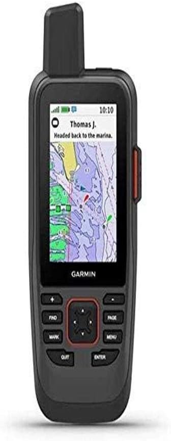
Garmin GPSMAP 86Sci
4.2Editor score
InReach satellite communication
Streams boat data remotely
Interactive SOS capability
Navigating open waters requires reliable tools to ensure safety and efficiency. A handheld GPS for boating provides essential positioning data when fixed systems fail or when you are far from the helm. Choosing the right device means looking at map quality, battery endurance, and rugged build standards suitable for marine environments.
We evaluated ten leading models based on satellite accuracy, screen visibility, and specialized marine features like MOB alerts and chart compatibility. Our analysis focuses on devices that float, resist water damage, and offer intuitive controls for use while wearing gloves or facing rough conditions. Each unit was assessed for real-world usability on different vessel types.
Each pick below highlights unique strengths such as preloaded coastal charts, satellite communication capabilities, or extended battery life. Prices and availability change frequently so verify current details before purchasing. We recommend comparing specs against your specific boating needs to find the perfect match for your voyages ahead.
4.2Editor score

4.0Editor score

4.4Editor score
As an Amazon Associate we earn from qualifying purchases.
This side-by-side comparison outlines key differences across all ten models to help you decide quickly.



The Garmin GPSMAP 79sc stands out as a top choice for boaters needing reliable navigation. It holds a solid rating and features preloaded BlueChart g3 coastal charts essential for safe passage. The rugged design ensures it survives bumps and splashes during active sailing trips.
We may earn a commission when you buy through this link, at no additional cost to you.
Key strengths include its ability to float and resist water damage at the unit level. The high-resolution color display remains readable even under bright sunlight conditions. Its memory capacity allows tracking thousands of waypoints which is vital for long voyages or complex routes.
Trade-offs involve the IPX6 rating which protects against rain but not full submersion. Battery life is decent at twenty hours but could be longer for expedition use. These limitations are acceptable given its core features tailored for coastal marine navigation.
Buy this if you need a dedicated marine navigator with built-in charts and durability. It suits sailors and anglers who value quick setup and reliable performance on the water without extra subscriptions.
BlueChart g3 charts provide detailed water depths and navigational aids right out of the box.
Support for multiple constellations ensures stable tracking even in challenging coastal environments.
We may earn a commission when you buy through this link, at no additional cost to you.
The Garmin GPSMAP 79s offers a simpler alternative with a worldwide basemap for general navigation. It shares the same durable chassis as the 79sc but lacks detailed chart data. This makes it ideal for travelers who prefer their own mapping data or use smartphone apps.
We may earn a commission when you buy through this link, at no additional cost to you.
Its floating design and water resistance provide peace of mind near the water. The electronic compass functions even when stationary which helps in tight docking maneuvers. Memory capacity supports thousands of waypoints so you can log favorite fishing spots easily.
While it lacks specific coastal charts the basemap provides basic terrain and route options. Battery performance matches the 79sc at twenty hours in GPS mode. For those who do not need preloaded marine charts this model saves money without sacrificing build quality.
Choose this unit if you want a robust GPS without the cost of detailed charts. It suits adventurers who rely on external map sources or need a reliable backup for offshore journeys.
Worldwide basemap ensures you have basic orientation data regardless of your destination.
Tilt-compensated electronic compass provides accurate heading readings even when standing still.
We may earn a commission when you buy through this link, at no additional cost to you.
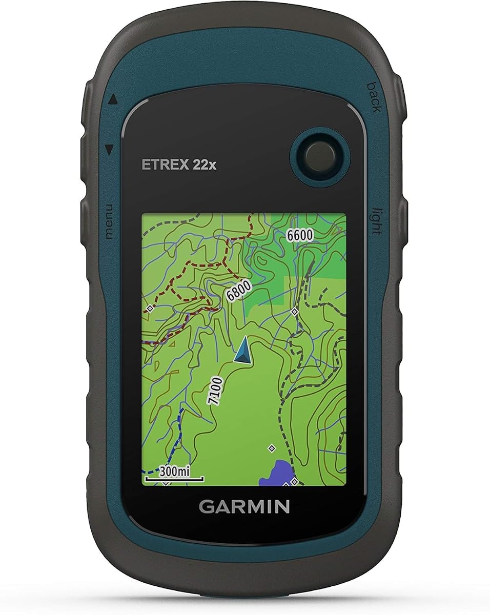
The Garmin eTrex 22x is primarily designed for hiking but works for coastal boat trips where terrain navigation matters. It comes with Topo Active maps covering roads and trails. Its battery life exceeds most marine units making it great for weekend adventures.
We may earn a commission when you buy through this link, at no additional cost to you.
Key strengths include the micro SD slot allowing users to load custom maps. The display remains clear in bright sun which helps during daylight sailing. Support for GPS and GLONASS improves accuracy in areas with weak signal coverage.
However it lacks marine alarms or floating capabilities which are critical on water. Water resistance is limited compared to dedicated marine GPS models. These trade-offs are acceptable if you prioritize battery life and map flexibility over specific boating safety tools.
Buy this if you need a versatile tracker for both boat and land excursions. It suits explorers who want to extend battery life and load their own map data for varied adventures.
Up to twenty five hours of use ensures you stay powered through long day trips.
Micro SD slot allows customization with local trail maps or chart updates.
We may earn a commission when you buy through this link, at no additional cost to you.
The Garmin GPSMAP 86Sci is the most advanced handheld offering satellite communication for remote areas. It combines detailed coastal charts with InReach technology allowing two-way text and SOS alerts. This feature set provides unmatched safety for solo sailors or those far from shore.
We may earn a commission when you buy through this link, at no additional cost to you.
Its ability to stream data from compatible chartplotters consolidates system information on one device. The sunlight-visible display and button operation ensure ease of use in rough conditions. Floatation and water resistance prevent loss overboard during active sailing.
The main drawback is the required satellite subscription for communication services. This adds ongoing cost beyond the initial purchase price. For serious boaters prioritizing safety and remote communication these costs are justified by the peace of mind offered.
Invest in this unit if you sail offshore or need reliable emergency comms. It suits professionals and adventure seekers who require top-tier connectivity and detailed marine mapping capabilities.
Interactive SOS triggers global search and rescue monitoring instantly for emergencies.
Remote control functions manage autopilot and other marine instruments from deck.
We may earn a commission when you buy through this link, at no additional cost to you.
The Garmin GPS 73 remains a popular choice for sailors seeking essential navigation tools. It includes SailAssist features like virtual starting lines and tack assist which aid racing performance. Its battery life supports long days out without needing frequent recharge.
We may earn a commission when you buy through this link, at no additional cost to you.
Dedicated backlit buttons make operation simple even when wearing gloves. Marine alarms such as anchor drag alerts ensure you stay informed while resting. The unit stores thousands of waypoints so you can revisit favorite fishing grounds easily.
While the display is smaller than newer models it remains readable in direct light. Lack of modern multi-band satellite support reduces accuracy in heavy canopy areas. These trade-offs are minor given its focus on core sailing functions and affordability.
Choose this if you want a proven device focused on sailing needs. It suits racers and casual sailors who prefer straightforward controls without complex digital overlays.
Tack assist and speed history help optimize your sailing strategy during races.
Backlit buttons allow quick adjustments in low light conditions without error.
We may earn a commission when you buy through this link, at no additional cost to you.
The Renewed Garmin GPSMAP 79sc delivers the same core features as new units at a lower price. It includes BlueChart g3 coastal charts essential for safe marine navigation. Most buyers report high satisfaction indicating quality refurbishment standards.
We may earn a commission when you buy through this link, at no additional cost to you.
Key benefits include the floating design and high-resolution display found on the new model. Water resistance remains robust for typical sailing environments. Capacity for waypoints and routes matches the original specification exactly.
Variations in battery life may occur compared to brand new units. Warranty terms often differ so check seller policies before purchase. These minor risks are acceptable for those seeking premium features without full retail costs.
Buy this if you want high-end performance at a discounted price. It suits budget conscious boaters who still need reliable marine charts and durability.
Renewed options provide access to premium tech at a significantly reduced cost.
All standard marine navigation tools remain intact for daily boating use.
We may earn a commission when you buy through this link, at no additional cost to you.
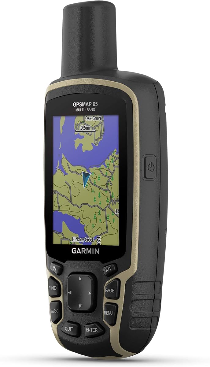
The Garmin GPSMAP 65 combines modern GNSS tech with button operation for versatility. Multi-band support improves accuracy in difficult areas like deep canyons or urban zones. Its display is bright enough for outdoor use without glare issues.
We may earn a commission when you buy through this link, at no additional cost to you.
It includes routable TopoActive mapping and public land maps for land exploration. Compatibility with the Explore app allows remote tracking and trip planning. This makes it useful for multi-modal travelers using boats and hiking gear.
Lack of specific marine charts or floating ability limits its primary boating use. However for general navigation needs it offers excellent accuracy and app integration. The high rating confirms its reliability in challenging environments.
Select this if you need a multi-purpose tracker beyond just water. It suits adventurers who value precise positioning and want to sync data with smartphones easily.
Multi-band tech ensures stable positioning even in obstructed or dense areas.
Explore app integration allows easy trip planning and data sharing.
We may earn a commission when you buy through this link, at no additional cost to you.
The Garmin eTrex 32x builds on the classic rugged design with added sensors. It features both a 3-axis compass and barometric altimeter for detailed tracking. This adds value for users who need elevation data alongside position.
We may earn a commission when you buy through this link, at no additional cost to you.
Battery life remains strong at twenty five hours on AA batteries. Micro SD slot enables loading custom maps for specific regions. The sunlight readable display ensures you can read coordinates without shade.
It lacks marine alarms and waterproofing suited for splashes. While not a dedicated marine unit it works for coastal kayaking where battery is key. The trade-off is reduced durability in salt water environments.
Choose this if you need long life and sensor data for land travel. It suits explorers prioritizing battery longevity over specific marine alerts.
Altimeter and compass provide elevation and heading data in any terrain.
Micro SD slot allows you to load regional maps as needed.
We may earn a commission when you buy through this link, at no additional cost to you.
The Garmin eTrex SE offers outstanding battery life for extended expeditions. In expedition mode it lasts up to 1800 hours on two AA batteries. This makes it ideal for long trips where recharging is difficult.
We may earn a commission when you buy through this link, at no additional cost to you.
It includes a digital compass and IPX7 water resistance which handles splashes well. Multi-GNSS support ensures accurate tracking in tough areas. Automatic cache updates via the Explore app add convenience for daily users.
While not floating it resists water better than most consumer trackers. The lack of marine charts limits its utility for serious boaters. Still it is perfect for light coastal activities where battery is the priority.
Buy this if you need a durable tracker with amazing power duration. It suits hikers and casual boaters needing reliable positioning without frequent charging.
Expedition mode allows nearly a week of use on single batteries.
Automatic cache updates keep geocaching data fresh without manual steps.
We may earn a commission when you buy through this link, at no additional cost to you.
The Garmin GPS 76 offers classic navigation features in a simple package. WAAS enables higher accuracy for coastal cruising and basic tracking. Its compact size fits easily in pockets or life vests.
We may earn a commission when you buy through this link, at no additional cost to you.
A built-in trip computer tracks speed and distance without needing extra apps. It supports up to twelve satellites for strong signals. Battery replacement is straightforward using two AA alkaline cells.
Display limitations mean it lacks detailed maps. However for basic waypoint tracking and return functions it remains reliable. The high rating confirms its durability and utility for basic navigation needs.
Choose this if you prefer simple and affordable tracking tools. It suits casual users needing basic coordinates without complex map interfaces.
WAAS capability improves positioning precision over standard GPS signals.
Trip computer tracks speed and distance for quick navigation checks.
We may earn a commission when you buy through this link, at no additional cost to you.
Selecting the right handheld GPS involves balancing navigation needs with durability and safety features specific to water environments.
Look for devices with preloaded coastal charts like BlueChart g3 to ensure you have accurate depth and navigation data without extra downloads. Some models include worldwide basemaps which are useful for general orientation but not for safe harbor entry.
Verify if the charts match your sailing regions before purchasing to avoid missing critical navigational aids or shallow areas.
Marine handhelds must float and resist water damage to survive drops overboard. Check ratings like IPX6 or IPX7 to confirm protection against splashes and rain. A rugged build ensures longevity against salt spray and physical impacts.
Prioritize units that float to prevent losing expensive equipment during rough conditions.
Battery performance dictates how long your device lasts during day trips. Look for 20 hours or more for full day coverage. Devices using AA batteries offer easy replacement in the field while rechargeable options need charging stations.
Choose battery types that align with your travel habits and access to charging sources.
Sunlight readability is crucial for navigation on open water. High-resolution color displays with anti-glare coatings ensure you can read coordinates clearly even in bright sun. A larger screen helps with map details but may reduce portability.
Test display visibility indoors to ensure text remains sharp and legible before buying.
Multi-GNSS support including GLONASS or Galileo improves accuracy in difficult environments. Devices with multi-band technology offer better signal stability in coastal areas with obstacles. This ensures reliable tracking even when signals are weak.
Opt for models with expanded satellite support to maintain position accuracy across varying terrains.
Man overboard alerts and interactive SOS capabilities can be life-saving in emergencies. Marine alarms for anchor drag or off-course warnings keep you informed while relaxing. Satellite communication requires subscription but adds critical safety for offshore boaters.
Prioritize safety features based on how far from shore you typically travel.
Intuitive interfaces with physical buttons allow operation while wearing gloves or in rough motion. Touch screens can be problematic when wet so buttons are preferred for marine environments. Look for clear menus and quick access to key navigation data.
Ensure the device offers dedicated buttons for functions like waypoints and course changes.
Models that support smartphone app sync allow easier route planning and data management. Compatibility with other marine instruments or chartplotters consolidates data on one device. Check if firmware updates are easy to access via software.
Choose devices that integrate smoothly with your existing marine tech ecosystem.
Start by charging the unit or installing fresh batteries before your first trip. Download any necessary map updates via the official app to ensure route data is current and accurate.
Calibrate the compass and allow the device to acquire satellite signal on land before entering the water. This initial setup ensures faster lock-on and more accurate position tracking once you are underway.
After each trip rinse the device with fresh water to remove salt and debris. Store it in a dry place and check battery contacts regularly to prevent corrosion and maintain long-term performance.
Most dedicated marine handheld GPS units are designed to float if dropped overboard. However standard hiking models may not float so check product specs carefully before purchasing. Verify the manufacturer states floating capability explicitly.
Preloaded coastal charts save you from buying extra maps and ensure you have detailed depth data immediately. These charts include safe water depths and navigational aids essential for avoiding hazards in shallow waters.
Satellite communication allows two-way text messaging and SOS alerts even far from cell coverage. This feature ensures you can call for help in emergencies and share your location with family or rescue services instantly.
Yes but hiking GPS units lack specific marine features like MOB alerts and floating designs. They may not offer accurate coastal chart data so dedicated marine models are safer for serious boating activities.
Devices using AA batteries are best for remote trips since they are replaceable anywhere. Rechargeable batteries are convenient for short trips but limit your range if you cannot access a charging station.
Rinse the unit gently with fresh water and wipe it dry with a soft cloth. Avoid submerging the device if it is not rated for it and store it in a dry place after cleaning.
Multi-GNSS support uses multiple satellite systems to improve accuracy and signal strength in challenging areas. This ensures reliable positioning near coastlines or under tree cover where single systems might fail.
Map update policies vary by manufacturer. Some offer free updates while others require a subscription or paid purchase. Always check the update policy before buying to avoid hidden costs over time.
The Garmin GPSMAP 79sc and GPSMAP 86Sci offer the most complete marine features including detailed charts and advanced connectivity for serious boaters.
Prioritize water resistance floating design and battery life when selecting your model to ensure reliability during long trips on the water.
Prices and availability fluctuate so verify current details before purchasing to get the best value for your specific boating needs.